RASP Spain
2 km soaring weather forecasts for seven Spanish free-flight regions, from GFS download to interactive map
Overview
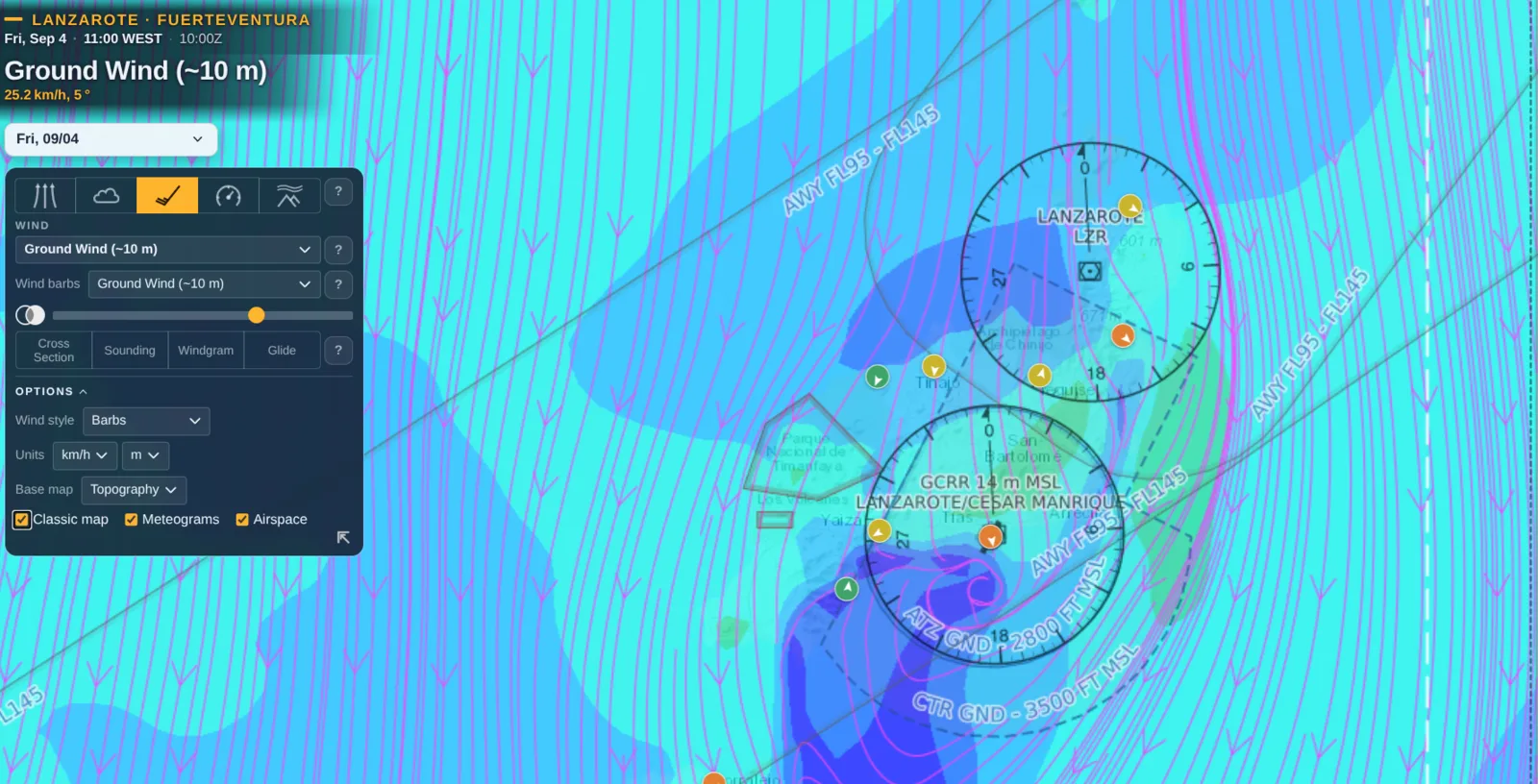
A complete soaring forecast stack: a numerical weather model run nightly on my own hardware, and the interactive map pilots actually read it on. Every morning the 0Z GFS is downscaled with WRF v4.7.1 to a 2 km grid over seven Spanish free-flight regions, turned into DrJack's classic BLIPMAP parameters, and published as overlays, per-takeoff meteograms and on-demand soundings.
Global weather models run at 10–25 km. At that resolution the phenomena that decide a paragliding day simply do not exist: the trade inversion capping Lanzarote at 1,200 m, the von Kármán vortex streets shedding downwind of Tenerife, the marinada that reaches Àger in the late afternoon, the poniente funnelling through the Strait. Commercial alternatives cost real money per region and answer to their own roadmap, not to what a pilot standing on a takeoff needs to know.
Two repositories with a deliberately thin contract between them. The producer runs GFS → WPS → WRF (MYNN-EDMF boundary layer) → RASP inside Docker, writing NCL contour charts, GeoTIFFs, meteograms and stripped wrfout files into a dated archive — nothing outside a region folder is region-specific, so a new flying area is a copied directory and a nest definition. The viewer is a dependency-light Leaflet app that samples those GeoTIFFs client-side to report the value under your finger, overlays wind barbs and streamlines independently of the parameter shown, and computes soundings, cross-sections, windgrams and glide range on demand from the raw model output via a Python WSGI backend.
Seven regions forecast daily — the whole Canary archipelago, the Aragonese Pre-Pyrenees, the Ésera valley, the Montsec and the Cádiz sierras — at a resolution that resolves the island wakes and the valley winds themselves rather than inheriting them. The viewer ships as separate editions: a pilot following a link to the Pre-Pirineo forecast lands in a site about the Pre-Pirineo, not in a Canaries page with a dropdown to operate first. It installs as a PWA and keeps working offline after one visit.